Cadastral number: what it is, why it is needed, and how to find out

Buying, selling, and inheriting land are impossible in Ukraine without a cadastral number. This set of digits transforms a physical plot of land into a legally defined object registered in the state registry. Sellers encounter this term when preparing documents for a transaction, which may raise questions: where to look for a cadastral number, why it is needed, and whether it is possible to do without it. In this article, we analyze all these aspects in detail.
What is a cadastral number
A cadastral number is a unique digital identifier of a land plot assigned to it during registration in the State Land Cadastre of Ukraine. The legal basis of this concept is enshrined in the Law of Ukraine "On the State Land Cadastre" No. 3613-VI: the number is an individual and unique sequence of numbers and signs for the entire country that identifies a specific plot.
There are no two land plots in Ukraine with the same number. Once assigned, the number remains with the plot for its entire existence as a separate object. Even if the owner of the plot changes, the number stays the same—only the details about the owner change in the registry.
The number is canceled or replaced with a new one in the following situations:
merging several plots into one;
dividing one plot into several parts;
other changes recorded in land management documentation.
It is important to understand the difference between a cadastral number and other property identifiers when preparing documents. A cadastral number is assigned to a land plot as an object of law, while capital construction objects—houses, apartments, non-residential premises—have a registration number of a real estate object in the State Register of Property Rights.
The keeping of plot records and assignment of numbers is carried out by the State Service of Ukraine for Geodesy, Cartography and Cadastre (StateGeoCadastre). The number is assigned based on technical documentation for land management, prepared by certified land management engineers following a cadastral survey of the plot boundaries.
What a cadastral number looks like
A land plot's cadastral number in Ukraine consists of nineteen digits, separated by colons into four blocks. The format looks like this: XXXXXXXXXX:XX:XXX:XXXX.
How this sequence is decoded:
The first ten digits are the code of the administrative-territorial unit according to the KOATUU classifier (or current classifier of territorial hromadas). This value indicates which region, district, and settlement or territorial hromada the plot belongs to. Each city, town, or village has its unique ten-digit value, so the first block determines which hromada the object is located in.
The next two digits are the number of the cadastral zone within this administrative-territorial unit. Large settlements are divided into several cadastral zones. Kyiv has significantly more such zones than a small village.
The third block of three digits is the number of the cadastral block within the zone. A block is a smaller territorial unit within a zone, usually corresponding to a building block or a compact land mass.
The last four digits are the sequential number of the land plot within this cadastral block. This digit changes most frequently and shows which number in sequence the specific plot was surveyed and registered within its block.
For example, the number 3210500000:01:006:7329 indicates that the plot is located in a certain territorial hromada of Kyiv Region, in the first cadastral zone of this hromada, in the sixth cadastral block, and has sequential number 7329 in this block. This number is never repeated anywhere else in Ukraine, so it is sufficient for unambiguous identification of the object in any authority.
The cadastral number must be specified in title documents for land: in an extract from the State Land Cadastre, in an information sheet from the State Register of Property Rights, in sales, gift, lease agreements, and technical documentation for land management.
Why a cadastral number is needed
A cadastral number is required for almost all legally significant actions involving land. Here are a few such situations:
Execution of transactions with a land plot—sale, gift, exchange, inheritance, or long-term lease. A notary is obliged to verify whether the plot is registered in the cadastre and specify its number in the text of the agreement. Without a number, the transaction will not be notarized.
Registration of ownership rights in the State Register of Property Rights to Real Estate. If a plot does not have a number, ownership rights to it cannot be legally recorded in the registry. Such a plot is formally not protected as a registered object.
Obtaining permit documentation for construction. Before obtaining the right to build, an investor or owner is obliged to confirm the designated purpose of the land and its boundaries. This can only be done through information linked to the cadastral number.
Connection to utility networks—electricity, gas, water supply. Before signing a technical connection agreement, utility companies verify the address and plot boundaries against cadastre data.
Obtaining a bank loan secured by land or real estate on it. Banks strictly check cadastral information before issuing a mortgage to ensure there are no encumbrances, arrests, or boundary disputes.
A cadastral number also allows a buyer to check an object before entering into a transaction. With its help, one can quickly find out up-to-date information about the plot: exact area, designated purpose, form of ownership, existence of usage restrictions (servitudes, protection zones, arrests), and history of changes.
Where you can find out the cadastral number
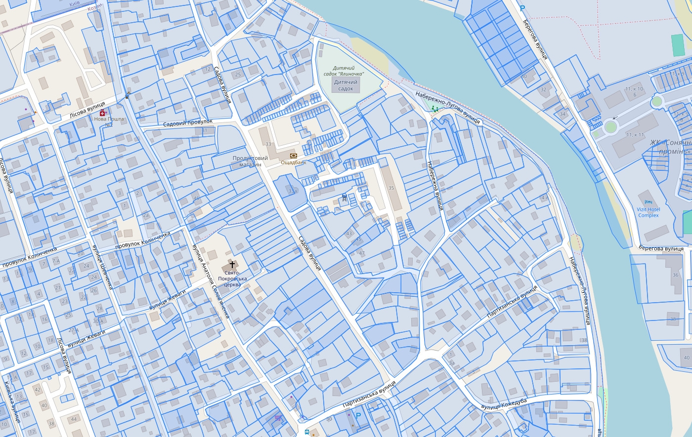
The Public Cadastral Map of Ukraine is one of the most convenient ways to find out a cadastral number. On the interactive map, you need to find the required plot visually or by address and click on it. The system will show the cadastral number, area of the plot, designated purpose, and form of ownership. Registration is not required on the website, and it is free of charge. However, keep in mind that information for some plots may be outdated.
Another option to find out the cadastral number is the electronic cabinet on the StateGeoCadastre portal. Here, you can get a more detailed information sheet about the plot if its coordinates or approximate location are known. An electronic digital signature may be required to enter certain sections of the cabinet.
You can also view the cadastral number in title documents for the plot. If the plot is already owned, the number is indicated in the sale and purchase agreement, deed of gift, certificate of right to inheritance, old-style state act, or extract from the register.
An extract from the State Register of Property Rights to Real Estate also contains the cadastral number of the plot if ownership rights were registered after 2013.
To find out the cadastral number, you can also contact a notary or an Administrative Services Center (CNAP). This method is suitable when you need an official, legally valid certificate with the number.
A realtor accompanying the deal also has access to specialized databases. They can verify the cadastral number of the plot, check it against actual boundaries, and ensure there are no discrepancies between documents and the real position of the object on the ground.
What to do if there is no cadastral number
The absence of a cadastral number means that the plot is not registered in the State Land Cadastre as an independent object. This is most common with lands inherited under old Soviet-style state acts, land shares allocated in kind but not fully processed, as well as plots formed as a result of division or merger without subsequent registration of changes.
What to do in such a situation:
Contact a certified land management engineer to develop technical documentation for land management. It is based on a surveying of actual boundaries of the plot with determination of turn point coordinates and area.
Submit the prepared documentation for registration to the StateGeoCadastre via the electronic cabinet or CNAP. Based on the review results, a unique cadastral number is assigned to the plot, and information about it is entered into the State Land Cadastre.
Register ownership rights to the plot in the State Register of Property Rights if this has not been done earlier. After that, the plot can be sold, gifted, inherited, or mortgaged.
The number assignment procedure takes a certain amount of time and involves expenses for land management services. Unexpected nuances may arise during the process, such as boundary overlapping with a neighboring plot or discrepancy of the actual area with document data. Such issues must be resolved at the documentation preparation stage.
Understanding the status of a specific plot, collecting the required documents, and completing the registration process up to assigning a cadastral number is easiest with professional support. Specialists from the "Mayak" Real Estate Agency will help check the plot, evaluate the need for a cadastral number, and advise what steps are required in your situation. Contact us to avoid legal risks when buying, selling, or registering land.